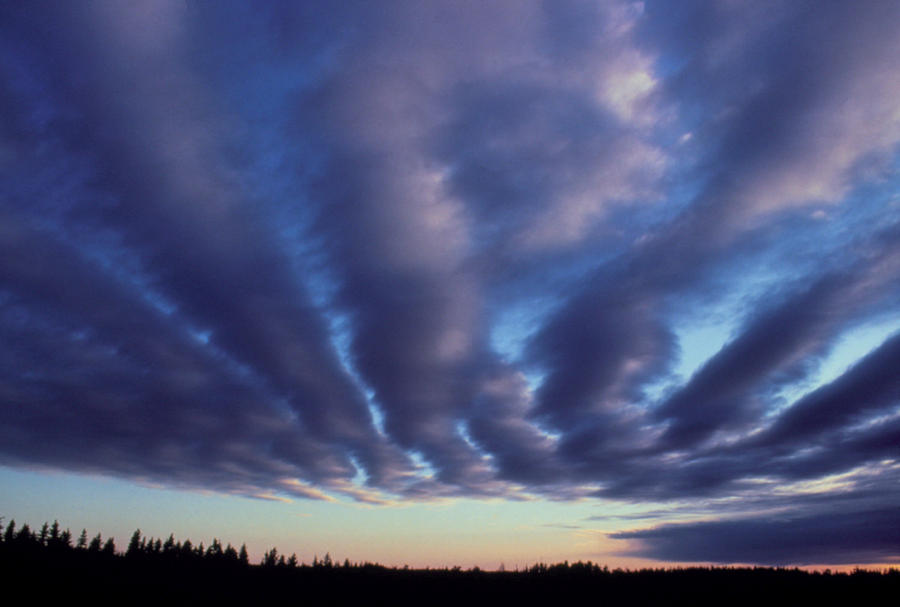
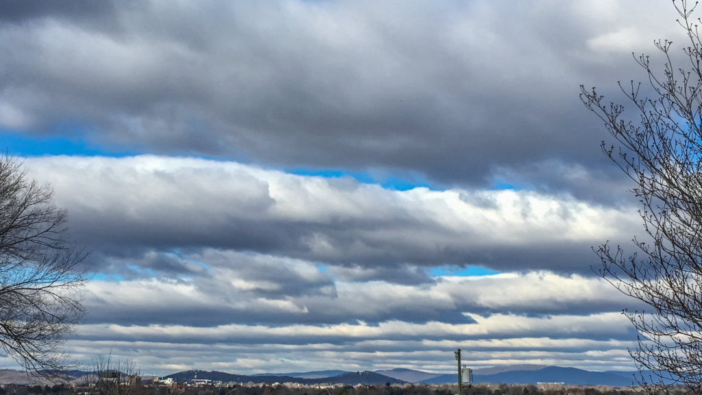
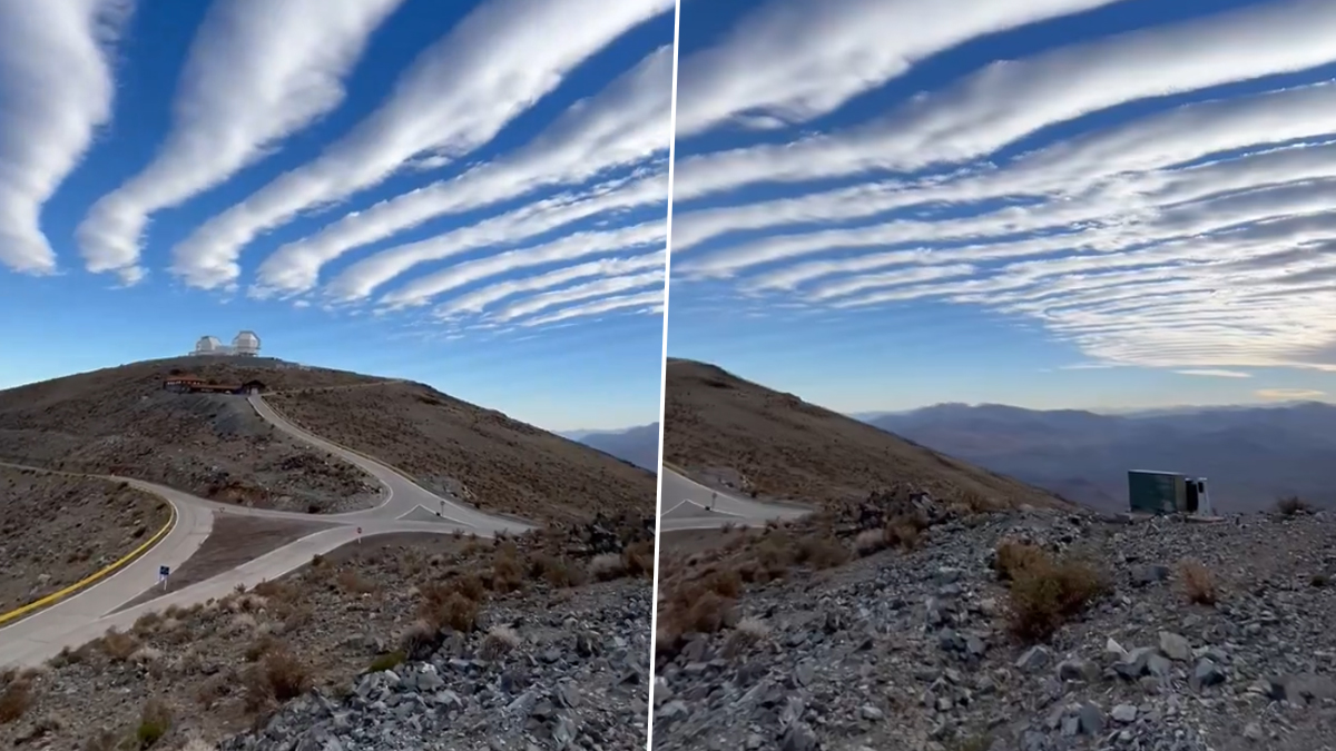
Stratocumulus clouds, a fascinating atmospheric phenomenon, made a rare and breathtaking appearance over the Atacama Desert in Chile on September 30. These low, layered clouds, arranged in horizontal bands, are not commonly seen in this region, making their presence a unique event for weather enthusiasts and scientists alike.
The incredible sight was captured by Yuri Beletsky, an astronomer and nightscape photographer, who shared the dramatic view on social media, showcasing one of nature’s rare spectacles.
Stratocumulus clouds are often associated with overcast weather, forming in large masses or patches across the sky. However, the sighting of this clouds in the Atacama Desert—a region known for its extremely dry conditions and clear skies—has caused a stir.
Read : Chile: Discover the Wonders of the World’s Longest Country
As one of the driest places on Earth, the Atacama Desert rarely experiences cloud cover of any kind, making this event even more remarkable. The video and images of the banded clouds quickly went viral, capturing the attention of meteorologists and weather watchers worldwide.
What Are Stratocumulus Clouds?
This clouds are a type of low-altitude cloud, typically forming at heights of around 1,200 to 2,000 meters (about 4,000 to 7,000 feet). These clouds often appear in large, gray, or white masses that blanket the sky, sometimes leaving small gaps through which sunlight can peek.
Unlike the towering cumulonimbus clouds that bring thunderstorms, stratocumulus clouds are generally associated with more stable weather, though they can occasionally lead to light drizzle or rain.
WATCH: Stunning 'Banded stratocumulus' clouds recorded over Atacama desert in Chile (🎥 Yuri Beletsky)
— Insider Paper (@TheInsiderPaper) September 30, 2024
pic.twitter.com/k1zBEpRM7F
The banded formation of stratocumulus clouds seen over the Atacama Desert is a rare sight. In this configuration, the clouds appear in parallel bands, stretching across the sky like waves.
These bands form due to variations in atmospheric pressure and wind patterns, which can create long rows of clouds aligned with the wind direction. The stunning appearance of the stratocumulus clouds in Chile, recorded on video, offers a rare glimpse of this atmospheric wonder.
The Significance of Stratocumulus Clouds Over Atacama Desert
The Atacama Desert is famous for its dry climate, receiving almost no rainfall throughout the year. It is also home to some of the world’s most advanced observatories due to its clear skies, making it an ideal location for stargazing and astronomical research.
The formation of stratocumulus clouds over this desert is an anomaly, as the region is usually characterized by a lack of moisture and cloud cover.
This phenomenon is particularly intriguing because it shows how atmospheric conditions in the region can change, even if temporarily.

The rare appearance of stratocumulus clouds in such a dry environment is likely due to a unique combination of weather patterns that allowed moisture to be carried into the region. As these clouds formed, they created a visually striking contrast with the vast, arid landscape of the Atacama Desert.
Yuri Beletsky, who captured the viral footage, is no stranger to the Atacama’s unique climate. He regularly photographs the night sky from the desert, taking advantage of its clear atmosphere to document stars, planets, and other celestial phenomena.
His latest capture of the stratocumulus clouds was unexpected, highlighting the unpredictable and wondrous nature of Earth’s atmosphere.
How Stratocumulus Clouds Form
Understanding how stratocumulus clouds form requires a look at the basic mechanics of cloud formation. Clouds form when moist air rises, cools, and condenses into tiny water droplets or ice crystals.
In the case of stratocumulus clouds, they typically form in stable air masses, where there is enough moisture for clouds to develop but not enough instability to create towering formations like cumulonimbus clouds.
Stratocumulus clouds usually form in the wake of a cold front or during periods of high pressure. The air is relatively calm, and winds tend to move in a steady direction, allowing clouds to form in long bands or layers. These bands often stretch across vast areas, creating a dramatic visual effect.
In the Atacama Desert, the formation of stratocumulus clouds is even more significant because of the desert’s typical lack of atmospheric moisture. This unusual event likely involved a shift in weather patterns that brought moist air into the region, allowing the clouds to form.

In coastal areas, stratocumulus clouds are commonly seen when cooler air from the ocean moves inland and interacts with warmer air. This is a frequent occurrence in places like California or Western Europe, but it is far less common in the arid regions of South America.
The appearance of stratocumulus clouds in the Atacama Desert suggests that a similar process may have occurred, with moisture-laden air from the Pacific Ocean moving inland and creating the conditions necessary for cloud formation.
The Viral Video: A Window Into Atmospheric Science
The viral video of the banded stratocumulus clouds over the Atacama Desert is more than just a stunning visual. It also provides valuable insight into atmospheric science, helping researchers understand the conditions that led to this rare event.
The banded formation of stratocumulus clouds is of particular interest to meteorologists because it reveals how wind patterns and atmospheric pressure interact to create these parallel cloud formations.
For the general public, the video offers a rare glimpse into one of the planet’s most extraordinary weather events. The Atacama Desert is not a place where most people expect to see clouds, let alone dramatic formations like stratocumulus clouds.
The stark contrast between the arid desert landscape and the low-lying clouds makes for a visually arresting image, one that has captivated viewers around the world.
As the video continues to gain traction online, it serves as a reminder of the beauty and unpredictability of nature. The fact that stratocumulus clouds—normally associated with humid, coastal regions—could form over one of the driest places on Earth highlights the complexity of Earth’s climate systems.
Stratocumulus Clouds: A Window Into Climate Patterns
While the viral video of the stratocumulus clouds over the Atacama Desert is a striking visual, it also provides valuable information for scientists studying climate patterns. Cloud formations like these can offer clues about changes in atmospheric conditions and weather patterns.

In particular, the presence of stratocumulus clouds in a typically dry region could be an indication of shifts in moisture levels or wind patterns, which might have broader implications for the region’s climate.
The appearance of stratocumulus clouds in unexpected places like the Atacama Desert may also offer insight into how climate change is impacting weather systems around the world. As global temperatures rise, weather patterns are becoming increasingly unpredictable, leading to unusual atmospheric events like this one.
The formation of stratocumulus clouds in such a dry environment could be part of a larger trend of changing climate conditions, with potential long-term effects on the region’s weather and ecology.
In conclusion, the rare sighting of stratocumulus clouds over the Atacama Desert has not only captivated the public but also provided valuable insights into atmospheric science.
As the video continues to be shared across social media platforms, it serves as a powerful reminder of the beauty and complexity of Earth’s weather systems. Whether viewed as a scientific anomaly or a striking visual spectacle, the banded stratocumulus clouds over the Atacama Desert are a testament to the wonders of nature.

